Elephants on parade

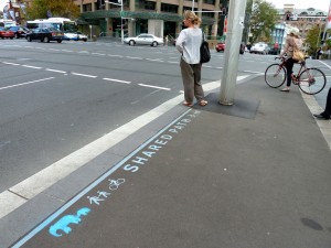
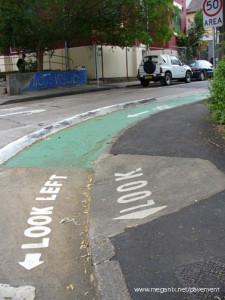
Shared path, College Street at Whitlam Square, Sydney, 2011


The relationships between cyclists, motorists and pedestrians are fraught and while some people are pleased with the new cycle lanes and shared pathways being installed by the City of Sydney, others are not. So it’s nice to see that some people have managed to keep their sense of humour.  Congrats  to the anonymous stenciller for this embellishment of a sign on the corner of College and Liverpool Streets, and thanks to the good sports in the Cycling Strategy department at the City of Sydney for drawing it to my attention.

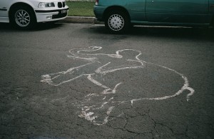
And while pondering the similarities (if any) between an elephant’s thick skin and the wrinkled greyness of the asphalt, I thought I’d dig out a couple more pavement pachyderms from my archives.

Elefant Traks music label, King Street, Newtown, 1999

Asphalt elephant, Queens Parade, Wolllongong, 2003

Feet

I’m sitting in a specialty shoe shop trying on different pairs and moaning about my crook feet. The shoe fitter says that it’s all because of the hard surfaces we walk on and goes on to tell me a slightly garbled story about this tribe of people in Africa who still go everywhere barefoot. I am inclined to think that people who habitually walk barefoot are not confined to Africa but I don’t say so. He’s doing his best to make me comfortable.

It is an annoying irony that I should have a fixation about photographing pavements and the writing on them, and yet I often have trouble walking any distance at all. In fact, when I took photographs of the Olympic marathon line remnants on Sydney Harbour Bridge, I was in a wheelchair. My daughter valiantly pushed me because I didn’t want a recent foot operation to prevent me taking part in the 75th Anniversary
Bridge Walk in 2007.

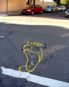
Wilson Street, Newtown, June 2008

Anyway, today’s photograph is dedicated to two distinct lots of people: those who always walk barefoot, wherever in the world they are; and the workers who maintain our roads and footpaths (and who sometimes have a joke when they are marking potholes that need repairing).

Island hoping

Since this blog has become something of a travelogue, I should write about Lord Howe Island, which I visited recently although it is not an ideal destination for someone hoping to study pavements and pavement graffiti.

A few facts and figures then. Lord Howe is a World Heritage island paradise located some 600 km east of the Australian mainland. Nearly all the roads on the island are sealed but there are only 10 km of them. There are very few kerbs, gutters or paved footpaths. The speed limit for the 100 or so motorized vehicles on the island is 25 km per hour, consequently there are hardly any street signs except for one or two Stop signs and several warning about Mutton Birds on Road and Woodhens on Road.

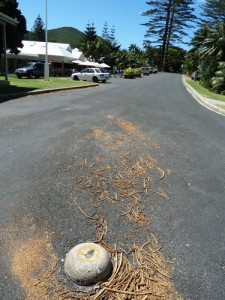
I kept an eye out for graffiti and traffic marks on the bitumen itself but found none. Well, almost none, except for one upside-down-pudding-bowl ‘silent cop’ (correct terminology: traffic dome) at the
T-intersection of Lagoon Road and Ned’s Beach Road, and some
angle-parking spaces marked out nearby.

The only other pavement embellishment I found was an exceedingly flat rat on the road outside the Museum (close-up view omitted in deference to the squeamish). Rats came to the island off the wrecked ship Makambo in 1918 and promptly set about making at least five native bird species extinct. Rat control measures have been in place since then. Although not totally successful, these measures are probably more efficient and certainly less random than squashing by car.

Writing on water – thoughts from Silverton (Guest spot)

This week’s post was written by guest spotter Julian Holland, who is a science curator and historian. Julian has been travelling recently in far western New South Wales.

Water – and there is a steady insistent drizzle as I write – water remains the central conundrum of the European experiment in settling Australia.  Water is invisible in most of the Australian landscape most of the time.  But sometimes – at rare intervals – it appears in abundance, even excess.  Much of the drive for Australia’s exploration in the nineteenth century was the search for water – for an inland sea around which agriculture could develop and for navigable rivers which could transport people and produce to markets.

But the explorers’ quest gave way to the reality of Goyder’s Line, the boundary in South Australia beyond which rainfall could not be relied on for agriculture.  The disjunction is marked on the landscape by a sudden shift in the character of vegetation.

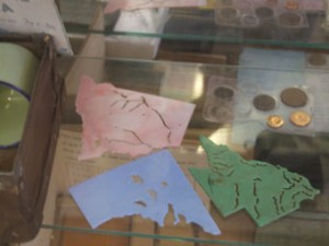
Yet the myth of water remains powerful.  In the old school house museum in Silverton, beyond Broken Hill, plastic stencils of different states reminded me of this.  Apart from their boundaries – coast lines and surveyors’ lines – the only features they could guide a child’s pencil along were the courses of rivers and boundaries of lakes, patterning impressionable brains with the idea of water in the landscape. 

But South Australia’s lakes are salt pans.  And perhaps the stencil-joints along the rivers should be read more literally.  Australia’s rivers are often no more than strings of waterholes.

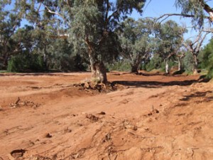
The river that runs through Silverton, Umberumberka Creek, most of the time doesn’t run anywhere.  It is a river of sand.  It is characteristic of Australia’s dry land rivers, visible in the landscape as a ribbon of larger trees, their roots embracing the invisible river below the sand. 

Instead of the ephemeral ripples of wind or insect or falling leaf – or the splash of oars – these rivers of sand carry slightly more enduring inscriptions.
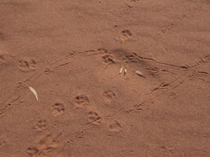
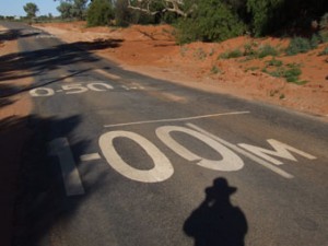
Heading back to Broken Hill, on the outskirts of Silverton, the road bows down in courtesy to a passing creek – a feeder to the Umberumberka – dry too much of the time to warrant a bridge, the possibility of water, or the probability of its absence, marked by lines and depth measures of 0.50 and 1.00 metres.  We inscribe the landscape and the landscape is inscribed in us.  The two landscapes do not always match.
Exhibition Road experiment

Exhibition Road in London is a mess. In a busy cultural precinct, it runs past the Victoria and Albert Museum, the Natural History Museum, the Science Museum and the Imperial College, and links South Kensington Station with the Royal Albert Hall and Kensington Gardens. But right now, from one end to the other, there are barricades, wire fences, earth moving equipment, temporary traffic lights and improvised pedestrian crossings.

It’s all part of a big experiment, with Exhibition Road planned to become the first shared-space street in London. Apparently the local residents are not happy with the scheme, presumably because they are less interested in accessibility for cultural tourists and more interested in parking spaces and easy access to and from the area for their very flash motor cars.

According to information posters hung from the wire barriers, the street will have “a kerb free single surface” and “visual and tactile lines distinguishing pedestrian areas from those used by vehicles”. Just this week workers have begun to pave some areas of the street with artificial cobblestones, forming geometric patterns in a range of designer greys. Road users will have to learn to read these patterns. When the work is all finished the paving will have become the instructions for its own use.

Look fight

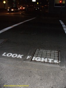
Look! There’s a fight going on down the street. That’s what this sign seems to be saying. And it’s true. There’s a constant struggle for territory going on in the streets and almost every sign, symbol, graphic and graffiti marked on the roads and sidewalks is evidence of this struggle.

I made a video (actually, a photo compilation) on this topic last year. Called Street Writing, it’s been published in the on-line Interdisciplinary Themes Journal. Turn your sound on while you watch.

Hicks, Megan. 2010. Street fighting. Interdisciplinary Themes Journal, 1(1).

The ‘Look fight’ photograph was taken several years ago in Harris Street, Ultimo (Sydney). I’m delighted to say it’s been added as a guest photo on the ‘Submissions’ page of one of my favourite websites, Misplaced Manhole Covers.

Hard judgement

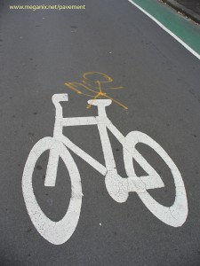
In an earlier guest blog, Bradley L. Garrett revealed his excitement upon discovering a pavement penis. Well, there’s a lot of them about.  These examples are in the inner Sydney suburb of Redfern, where encroaching trendiness has turned a closed-off street beside the railway line into an official bicycle route and a parking lot for cultural-industry workers and the newer type of resident.

Older established residents and their offspring may well feel resentful. I choose to believe that these alterations of official traffic signs express a local belief that the car parkers and cyclists are wankers.